|
Imágenes Satélite
| |
|
|
Baghdad,
Irak |
Baghdad,
Irak |
 (119
Kb.) (119
Kb.)
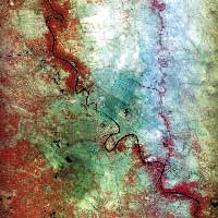
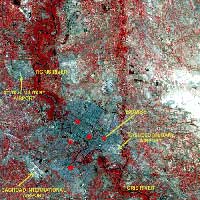
KITSAT-3
Low-resolution Infra-red satellite image of Bagdad City
area. |
 (70
Kb.) (70
Kb.)
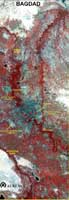
Low-resolution color satellite image of Bagdad City area. |
|
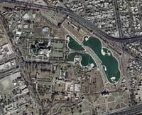
Baghdad,
Irak |
Baghdad,
Irak. First War 1991 |
 (50
Kb.) (50
Kb.)
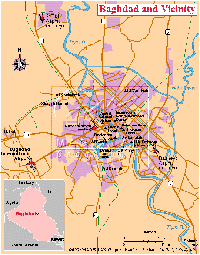
Baghdad and vicinity map.
|
(76 Kb.)
(203 Kb.)
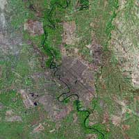
Landsat
Low-resolution Infra-red satellite image of Bagdad City
area. |
|
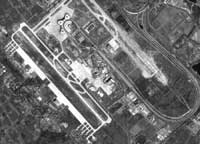
Baghdad Airport,
Irak |
Baghdad,
Irak |
 (101
Kb.) (101
Kb.)
IRS
High-resolution B/W IRS Satellite image of Baghdad
Airport |
 (2.3
Mb.) (2.3
Mb.)
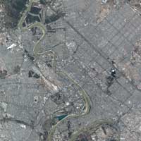
DigitalGlobe
Very High-resolution (0,6 m) Color QUICKBIRD Satellite
image of Baghdad. The image resolution was downsized.
February 6, 2002 |
|
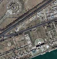
Al-Sujud Palace, Baghdad, Irak |
Al-Salam Palace, Baghdad, Irak |
|
 (401
Kb.) (401
Kb.)
DigitalGlobe
Very High-resolution (0,6 m) Color QUICKBIRD Satellite
image of Al-Sujud Palace, Baghdad. September, 10,2002 |
 (401
Kb.) (401
Kb.)
DigitalGlobe
Very High-resolution (0,6 m) Color QUICKBIRD Satellite
image of Al-Salam Palace, Baghdad. September, 02,2002 |
| |
|
| |
|
|


