Introduction
Kuneitra, Kuneitra, Al Qunaytirah or Qunaitira was once a
bustling town in the Golan Heights and southwestern Siria's
administrative capital with a population of 37,000 but it was
completely destroyed by Israel during the 1973 War. It is situated
in a high valley in the Golan Heights at an elevation of 1,010
metres above sea level. Kuneitra was founded in the Ottoman era as
a way station on the caravan route to
Damasco and subsequently
became a garrison town of some 20,000 people, strategically
located near the border with Israel. The word Kuneitra derives
from Qantara, or 'bridge', between Siria, Lebanon, Jordan, and
Palestine.
On 10 June 1967, the last day of the Six-Day War, Kuneitra was
occupied by Israel. It was briefly recaptured by Siria during the
1973 Yom Kippur War, but Israel regained control in its subsequent
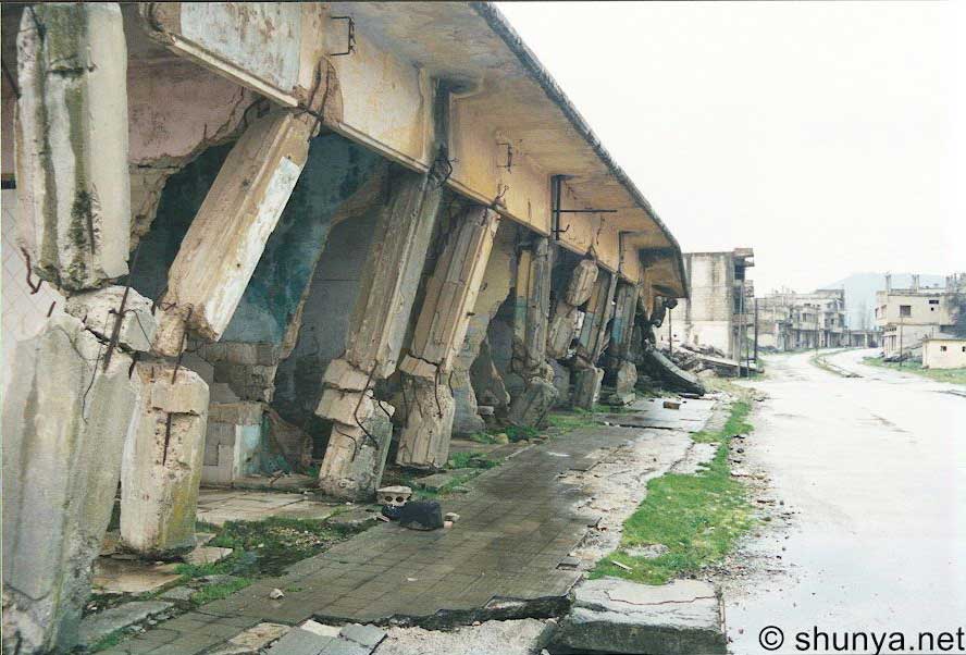
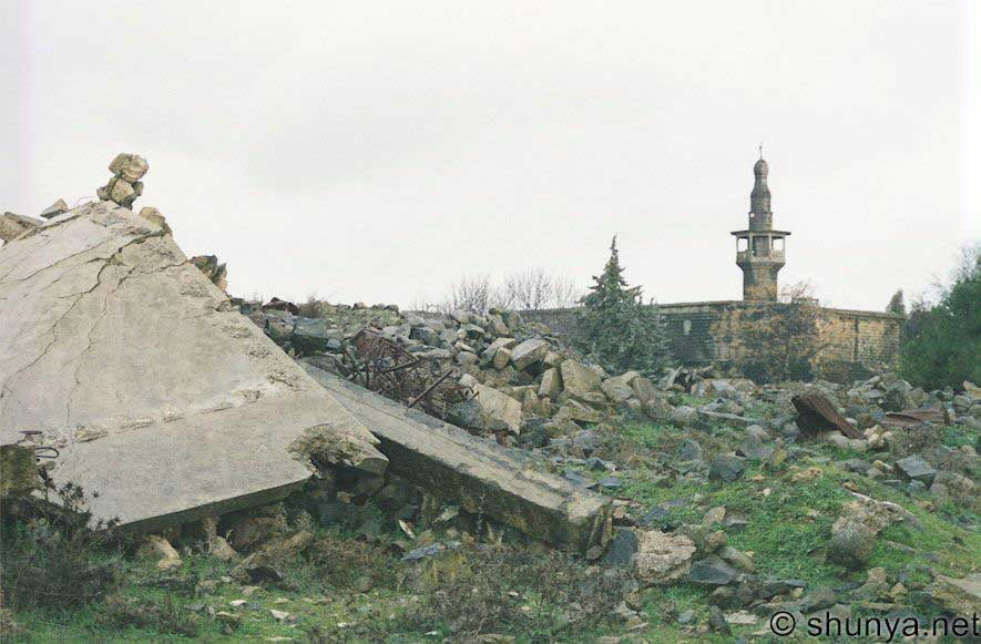
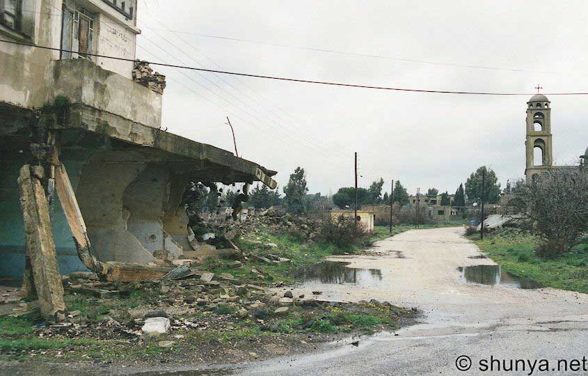
counter-offensive. The city was almost completely and
systematically destroyed by the Israeli army before the Israeli
withdrawal in June 1974 (UN General Assembly resolution 3240 in
1974 condemned Israel's role in its destruction). Kuneitra now
lies in the demilitarized United Nations Disengagement Observer
Force (UNDOF) Zone between Siria and Israel, a short distance from
the de facto border between the two countries. Israel was heavily
criticized by the United Nations for the city's destruction, while
Israel has criticized Siria for not rebuilding Kuneitra. Many
prominent Western reporters, agreeing with the UN and Syrian
version of events, saw this as nothing short of an act of wanton
brutality — a whole town methodically ransacked, dynamited, and
bulldozed.
History
Kuneitra is known for its abundant water resources, it has been
continuously inhabited since the Stone Age. Over the millennia,
many peoples, including Arameans, Assyrians, Caldeans, Persians,
Greeks, and Arabs have occupied it. St. Paul, it is said, passed
through Kuneitra on his way from
Damasco to Jerusalem.
The surrounding area of
Kuneitra has been inhabited for millennia. Palaeolithic hunter-gatherers are thought to have lived there, as
evidenced by the discovery of Levallois (distinctive type of flint
knapping) and Mousterian flint tools in the vicinity. Traces of
this have been found at Banat Yacoub bridge and Tell Akkash. It
was later occupied by the Amorites, who established their state in
2250 BC. They were succeeded by the Arameans, the
Assyrians, Caldeans, and then the Persian and Hellenistic empires.
Saint Paul is said to have passed through the settlement on his
way from Jerusalem to Damasco. The site of the Conversion of Paul
was traditionally identified with the small village of Kokab,
north-east of Kuneitra, on the road to
Damasco.
In 106 AD the Golan was part of the Arab state that was
established under the Romans. In 636 AD the battle of Yarmouk took
place between the Arabs and the Byzantines who were banished from
Siria.
The modern city grew around the nucleus of an Ottoman
Caravanserai, which was built using the stones of the ruined
ancient settlement. By the 20th century Kuneitra had become the
administrative centre for the Golan region and a centre of
settlement for Muslim Circassians from the Caucasus. During War
World I, the Australian Mounted Division and 5th Cavary Division
defeated the Ottoman Turks there on September 29, 1918, before
they took
Damasco.
Kuneitra was taken over in 1967 by the Israelis. In
1973 with the October war, it was taken back into Syrian territory after being
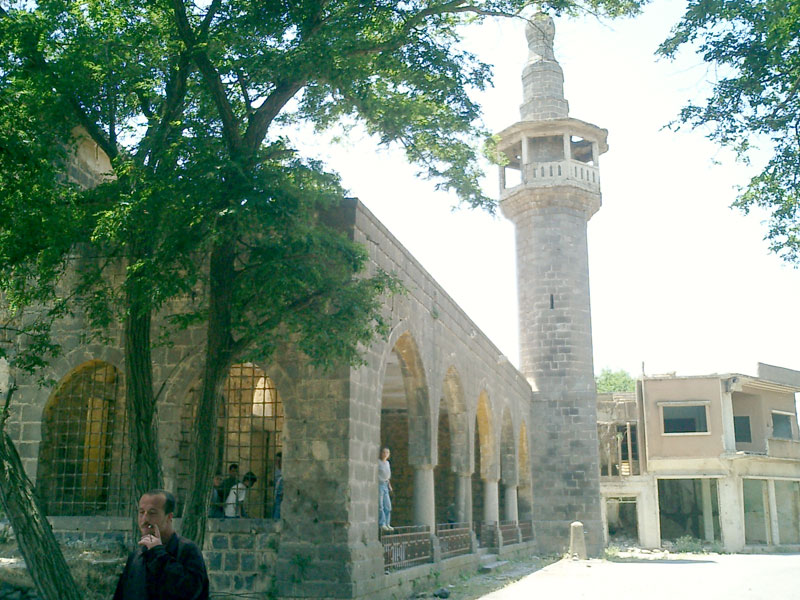
completely destroyed by Israel. The city had been systematically
stripped by the Israeli forces, with anything movable being removed and sold to Israeli contractors. The empty buildings were subsequently pulled apart with tractors and bulldozers.
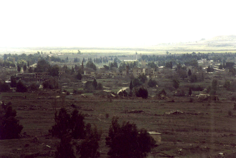
Siria has left the ruins of Kuneitra in place and built a museum to
memorialize its destruction. It maintains billboards at the ruins
of many buildings and effectively preserves it in the condition
that the Israeli army left it in. The former residents of the town
have not returned and Siria discourages the re-population of the
area.
|